Posts

Showing posts from March, 2019

CRM Yuneec H520 Field Notes & Pre-Flight Checklist

CRM Yuneec H520 Field Notes & Pre-Flight Checklist Metadata Pilot: Lucas Wright Platform: Yuneec H520 Location: Martell Forest Date/ Time: 3/26/2019, 11:20 am EST Altitude: 80m Weather/ conditions: Clear, 50 degrees F, 0% precipitation, no wind Aeropoint GCPs GCP 747 placed on south side of field near rock and dirt pile GCP 034 placed further west at the corner of the shed and road GCP 420 placed near cages at west end of field GCP 360 placed in the clearing near the cages GCP 943 placed on a hill at the far end of the trills GCP 205 placed at the southeast corner GCP 142 placed in the middle of the field near a prairie GCP 500 placed in the middle of the field on the south side GCP 491 placed at the east corner of the trees GCP 217 placed near the truck/take-off point Pre-Flight Checklist: Check Airspace of Operation and contact necessary organizations if needed Check NOTAMS and for TFRs Ensure Weather is Safe For Flight Properly ...
Calculating Impervious Surface Area

Image
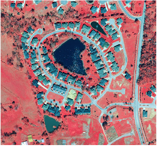
Introduction In this lab we will segment and classify aerial imagery by land use in order to calculate the amount of impervious surface area per parcel of land. Some municipalities will charge home/land owners extra fees based on the amount of impervious surface area on their land because too high an amount of it can cause flooding issues. Methods Segment the Imagery We first started by downloading the dataset from the ArcGIS tutorial website. The lab begins by extracting the spectral bands in order for us to better distinguish some of the urban features, like concrete, from natural features, such as vegetation. The extracted bands are 4, 1, and 3 which respectively emphasize vegetation, man-made objects, and water. Figure 1 shows the image after band extraction. Figure 1: Extract Bands function used We utilize the classification wizard is used throughout much of this lab to help us classify different parts of the image. However, we leave the image segmentation alone...

Volumetric Analysis with UAS Data

Image
Introduction Volumetric analysis is a type of analysis often used in conjunction with UAS data to determine the amount of soil/material added to or removed from an area. It is an analysis of the volumes of a specified area. Volumetric analysis can be performed for many different purposes. When moving soil away from one location, it can be used to determine how much soil has been moved in a certain time frame to help give accurate time assessments for future projects. It can be used in mines for determining how quickly work is happening. Two methods utilized in this class to perform volumetric analysis are using Pix4D volume calculations and ArcMap volume calculations. UAS data is very valuable for these types of analyses because of the ease of access to data, and the high quality of the data. The higher quality, the more accurate the calculations can be. The easier it is to acquire data, the more often the data can be taken. Methods Pix4D Wolfpaving Calculations Volumetric cal...